Trying to travel without a car or airplane from San Francisco
A list of places I’ve tried to travel without a car (with a few failures), and what I’ve learned doing so. All trips start in San Francisco. I’ll leave the topic of camping to a separate post.
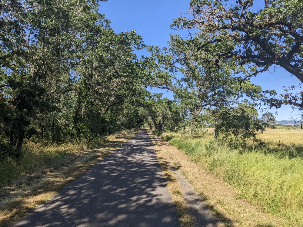
The SMART train
This train seems like it shouldn’t exist in the US. It’s very convenient, especially with a bike, very scenic, and it connects large parts of the North Bay together, a sprawling region of small towns and agricultural areas.
However, it’s a bit annoying to get to from San Francisco. You can get on at Larkspur, or San Rafael. Both can be reached by bike, either by the long and scenic route of going over the Golden Gate Bridge, or from the East Bay over the San Rafael Bridge. I’ve taken the BART to the East Bay, gone up the Ohlone Greenway and over through Richmond, and over the bridge for the fun of it. There’s some good food in Richmond immediately before you cross the bridge. It’s a nice ride and they might close the San Rafael bridge to bikes soon. Also, the connection from the bridge to San Rafael is not great - there’s a highway route, but I took a very hilly and roundabout alternate route.
You can also take the ferry to Larkspur, with or without a bike. I would recommend that for the return trip regardless.
Santa Rosa#
Recommended (with a bike)
I’ve come here twice, once alone and once with others. This is a very bike friendly place. Transit seems more limited, though, and I haven’t tried it, and most of the things I enjoy doing here involve a bike.
When you get off the train, you will immediately be surrounded by some ugly and unpleasant parking lots, which are deserted, maze-like and unsafe at night. I was definitely glad to have a bike here. When the shopping mall is closed, there’s no good way to walk thorugh. However, once you get past the endless parking lots, it’s pretty pleasant, although it seems like walking long distances is not incredibly common.
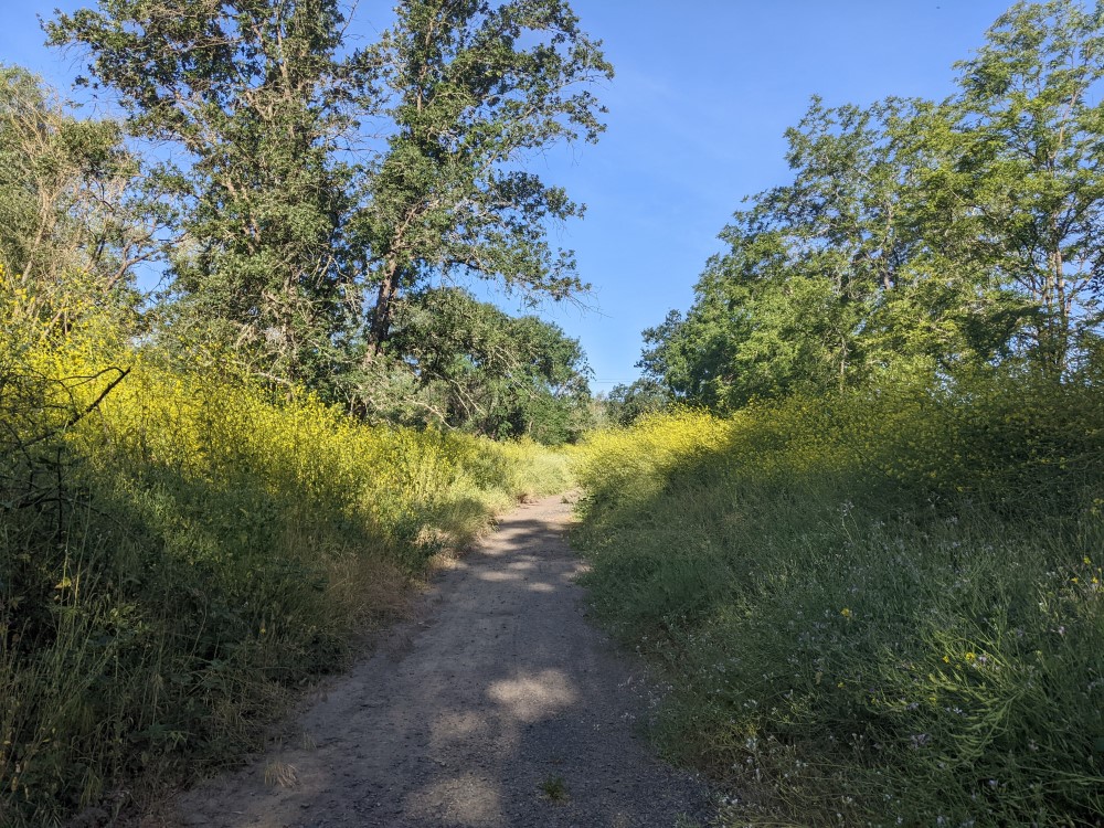
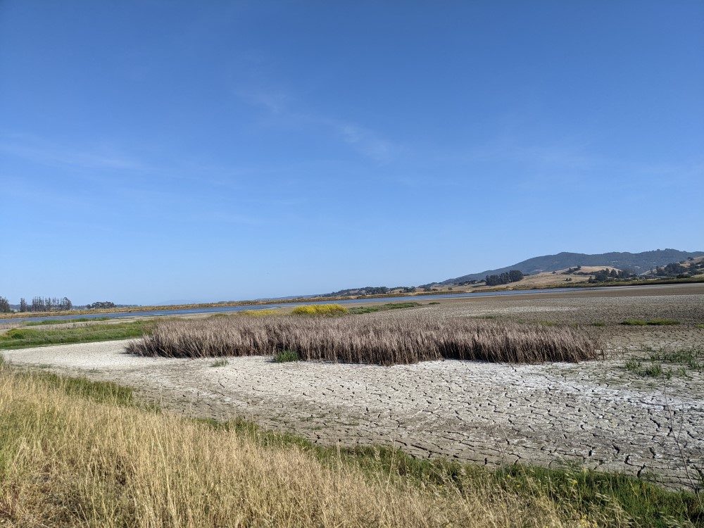
The town connects to a lot of car-free multi-use paths that go a long distance, which are generally pretty flat, pleasant and isolated from traffic, and some of them have stops along the way specifically to cater to cyclists, where you can get a coffee or a bite to eat. However, they do cross major roads - many of them basically highways - and some of the crossings are not ideal, but fine if you take your time. One of the major routes goes to Sebastopol, which is a nice little town of breweries, coffee shops, restaurants, and stores selling vaguely handmade things, of the sort that you probably look at without buying anything.
You can continue to Forestville, which is not very walking or bike friendly, but it’s so small it’s not a huge issue. Wwhen I was there there were signs about a town meeting about fixing the sidewalks, and it was immediately clear why this meeting was happening. It contains an interesting store called Lucky Mojo Curio Company, which is worth a visit, if only for the elaborate outdoor train themed garden. It’s a bit hard to find - it’s in a very residental area, and is behind a large hedge. The path from Sebastopol to Forestville also takes you through some interesting areas: marshes, vinyards, forests, and past an assortment of farm animals. If it’s hot, bring lots of water. Your opportunities to refill a water bottle are limited, with the main one being a small corner store in Graton where you can buy bottled water.
There are other paths worth exploring: when I went, there was one that went along the river which eventually petered out into gravel and overgrown grass. Alternately, head south on the path along the train tracks and you can reach Henhouse Brewing. It might be possible to go further south to the next town, I haven’t tried it.
Petaluma#
Could be fun with a bike and an adventurous attitude
This is a nice little town that is somewhat bikeable, athough it seems biking for transportation is rarely done. I visited in Spring 2022, so my information might be a bit out of date.
I stayed in an Airbnb here. My hosts were extremely impressed that I biked a very short distance with my bags on my bike from the train station, they had never heard of such a thing before. I’m not sure what the hotel situation is here.
Ignore the Google map directions regarding bike lanes, and stick to residential streets. The streets with the bike lines are major streets with lots of traffic and really bad bike lanes, but the residential streets are pretty quiet.
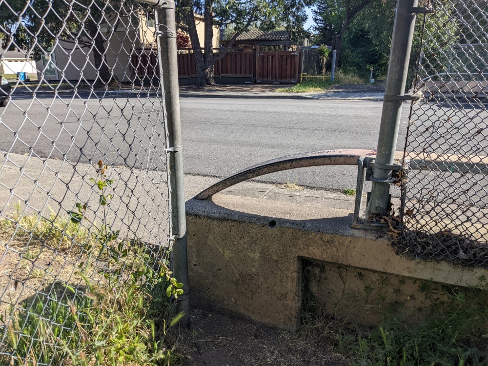
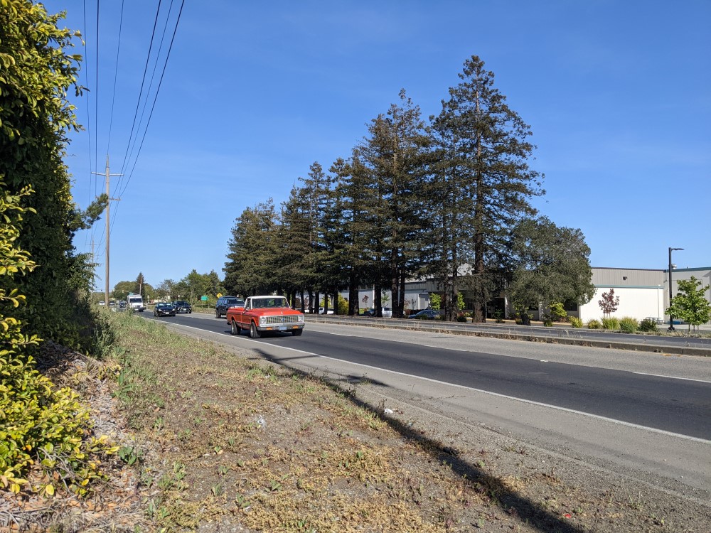
There is a bike trail that takes you around town and ends at a bird sanctuary. The bird sanctuary is quite beautiful, and worth a visit. The quality of the bike trail, as described on the city website, is greatly exaggerated. I found myself needing to lift my bike over a barrier and then wait for a gap in highway traffic to cross at some point. I also could have not been stubborn and instead turned back at this point and gotten a pretty decent bike ride in, I just really wanted to see the birds.
Here’s what the barrier looks like, on the official bike route recommended by the city, that I had to lift my bike over:
Here’s what the highway I unexpectedly found myself needing to cross looked like:
It occurred to me somewhere around here that this supposed bike loop was maybe not complete, and maybe I was not supposted to attempt to ride it in the year 2022, and perhaps in the year 2023 (or beyond, whenever you are reading this) it will be a better experience.
The bird sanctuary was beautiful, but my camera isn’t much good at photographig birds.
SLO by Amtrak
Recommended, don’t need a bike, with some patience In fall 2021 I went to San Luis Obispo. It’s more or less a college town, with the sort of midsize downtown of quaint and slightly expensive shops that cater to the adults who find themselves living there. There’s a nice farmer’s market where they close the main streets.
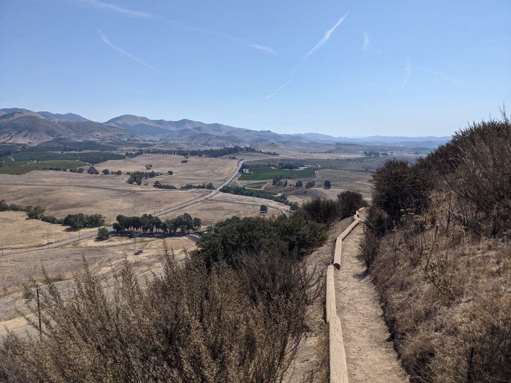
Most importantly, though, it has adequate public transit that connects you to some really nice hiking. (I think the transit schedule varies based on whether or not school is in session, so check before going). It is surrounded by those dry California hills that you saw outside of your Amtrak window, and you can go climb up one of them (make sure to bring water). The area is also geologically interesting.
Morro Bay#
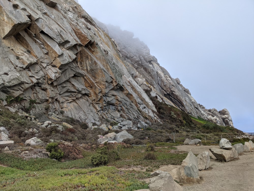
My top recommendation from SLO is taking the bus to Morro Bay. It comes once an hour, but was very much on time. Morro bay is beautiful, full of fascinating rock formations and wildlife (in particular, sea otters).
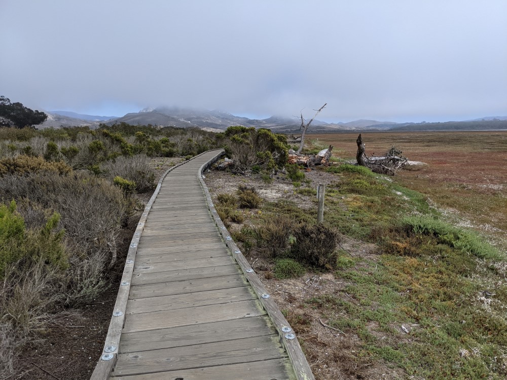
I also walked to the state park boardwalk to see more birds. The walk was a little annoying - not super pedestrial friendly, but doable - but it was worth it.
The core downtown area is pretty walkable, though. There are lots of art galleries and shops that specialize in things like beads, or sea shells. You’ll definitely be able to kill time before waiting up to an hour for the bus home.
Pismo Beach
Needs more research to be fully car-free. Beautiful but car-oriented
Having remembered what a nice time I had in Morro Bay, I had the idea to go from SLO to Pismo Beach and then take the Surfliner from Pismo Beach onwards.
Pismo Beach is significantly less pedestrian and transit friendly than Morro Bay. In fact, I got the impression that going even 5 minutes without a car was unthinkable to most of the people there. It’s also a much smaller, and more conservative, town. There isn’t much to do, aside from hiking or the beach. I felt particularly out of place here, both demographically and by not having a car, and there were definitely some signs of far right beliefs in terms of the signs and flags I saw. Pretty much all of these places I’m listing feel very homogenously white, but in the way that you might have a sign displaying your progressive values on your very expensive house, and this is not that kind of place.
That being said, it is very beautiful, especially the beach. If you are very careful and go at low tide, there are some really cool caves along the beach, but definitely don’t get trapped there when the tide comes in. I’m reluctant to recommend this just because it seems a bit risky if you aren’t paying attention.
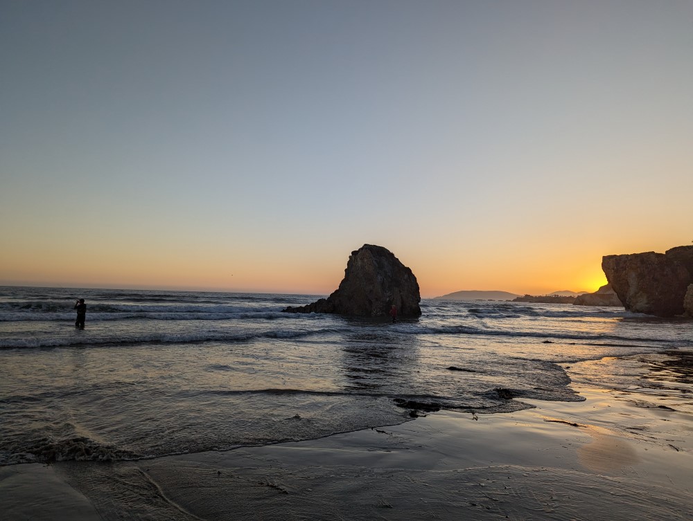
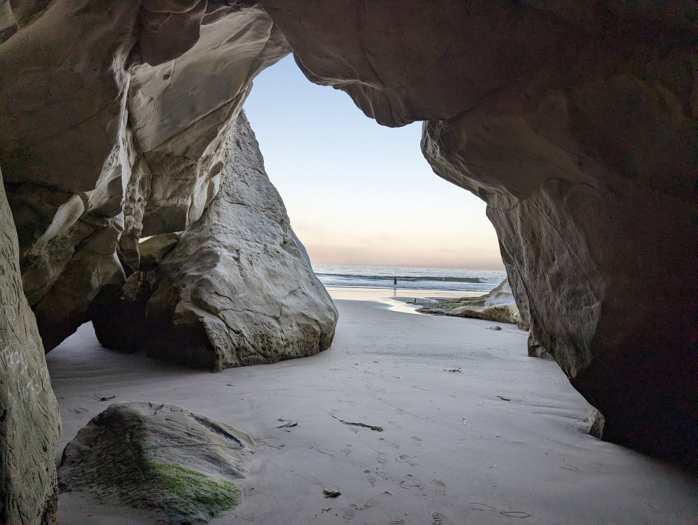
I stayed in a motel near where the caves are, whch allowed me to visit them at low tide, and also walk to Pismo Preserve, the hills above Pismo where you can hike. It’s generally a great location except that it’s a pain to walk to a place that sells food, or the train station.
Walking around is in many places technically possible but unpleasant, due to the heat and the loud and fast traffic beside you. In other places, Google Maps suggests you should walk on the highway. What I ended up doing was breaking my no car rule to get there from SLO (as I’d missed the bus, and Google told me that although the bus was only a 20 minute walk from the hotel, I’d have to walk on a highway). To get from the motel to the train station, I walked along the beach. Fortunately I brought a duffel bag and not a roller bag, and even so I ended up needing to take my shoes off and wade in some places to reach the train station in Grover Beach. Incidentally, you are allowed to drive on Grover Beach!
I suspect having brought a bike would have made it worse.
The train station has no amenities or attendant of any kind, however, there is inexplicably a tiny wine tasting room attached to the train station parking lot, which I would recommend. There is a dog, and lots of quilts, and very few customers.
Pismo Beach to Santa Barbara by Amtrak#
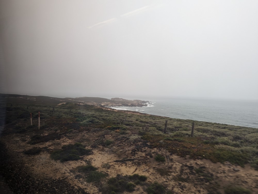
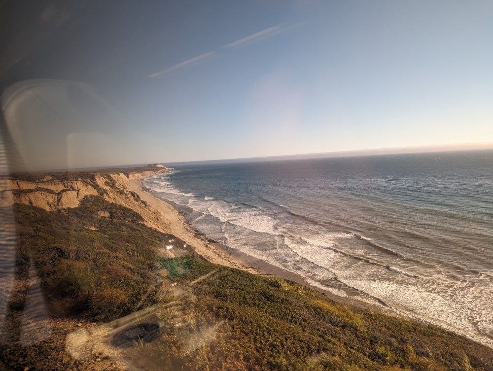
The Amtrak ride south was very much worth it. It goes along the coast and is very beautiful, shifting from a kind of Gothic scenery of wind-swept, foggy trees along the coast interspersed with abandoned power lines, transitioning to a bright and sunny seaside with dramatic cliffs.
Santa Barbara
Recommended, don’t need a bike but it’s helpful if you are able to use the bikeshare Fhe city bikeshare bike monthly pass is an amazingly good deal. It’s $7 per trip by electric city bikeshare bike (they have no non-electric ones), but $30 for a monthly pass, and if you have been walking a lot, it’s very easy to rack up the 5 bike rides needed to make it worth it. Everything is within walking distance, but after my Pismo Beach adventure my feet were quite tired.
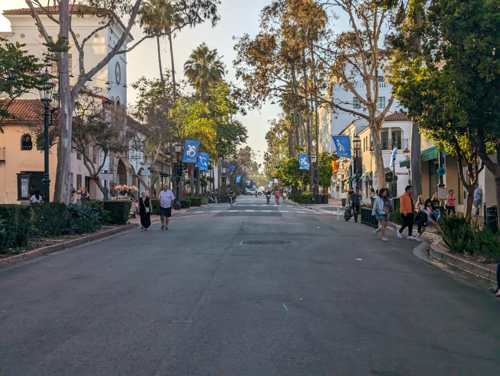
The one thing that was far was the historic Mission building. The now mostly car free State Street makes walking generally very pleasant, and is worth visiting if only so you can be angry at your local politicians that they haven’t implementd this back home.
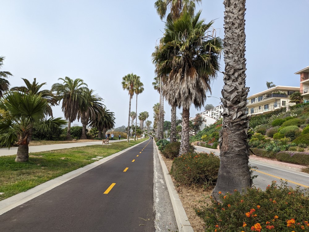
Another reason to get a bike - though I rented a conventional bike for this - is to bike along the waterfront, where you can mostly avoid sharing space with cars. If you keep going west you go up a hill, at which point you are biking alongside cars who inexplicably seem to be trying to spend as little time enjoying the view as possible, and so I turned back, but based on Strava it seems like that is a popular direction to explore. Going east, I biked just into Montecito, which was beautiful except for one really sketchy road you have to cross. If I were to go again and bring my own bike, I’d probably have kept going.
The one thing with the bike share ebikes is I kind of wish they weren’t ebikes. Most of the time you’ll be going up and down State Street, or maybe along the multiuse path by the river. These areas are flat and shared with pedestrians, so there’s no reason to need an ebike for most people, and the ebike mostly seems to just increase the risk of conflict with pedestrians. Santa Barbara is a place for going slow.
They’re also a bit unreliable: a few times, especially at the peak of the day when there were a lot of people around, I lost cell connectivity which was needed to check one out. Also, while there are docks every block on State Street, they come in groups of like 4. So either they are likely to be all full, if you want to drop a bike off, or all empty, if you want to pick one up. This wasn’t a huge problem for me, except that when I went to the Mission I had to park my bike a 15 minute walk away, uphill, on a hot day.
If you look at this photo, you will see several characteristics of State Street: People walking and riding a bike; no car traffic except for cross traffic, as enforced by the tiny planter box you can see next to the tiny white car; and someone taking the last bike from the bike dock:
I also recommend staying within walking distance of State Street, rather than the more expensive hotels by the beach, especially if you’re able to ride a bike.
In terms of other things to do, it’s a fun town to just walk around, there’s also a lot of historically interesting buildings with ugly histories behind them which are acknowledged to various degrees, and a few (very small but interesting) art galleries. There was a mead place called Wydle Works which had live music, oudoor space (and the indoor space open to the air), and interesting and unique drinks. Unfortunately, their gofundme suggests they may not be doing great financially. There are some nearby islands that are also national parks, but I didn’t book a trip there early enough in advance. I would come back for that.
Santa Barbara is, I think, even more expensive than San Francisco.
Portland by Amtrak
Worth a visit, strongly recommend bringing a bike on the train as transit is surprisingly bad
This was in late 2022.
You can get here by Amtrak. Make sure to dress for the weather and in particular, bring gloves. It’s a longer Amtrak trip - it’ll be overnight.
The most memorable part to me was riding my bike around the perimeter of the river. There’s a separated bike path and it’s very nice, and largely flat, aside perhaps from when you might go over a bridge.
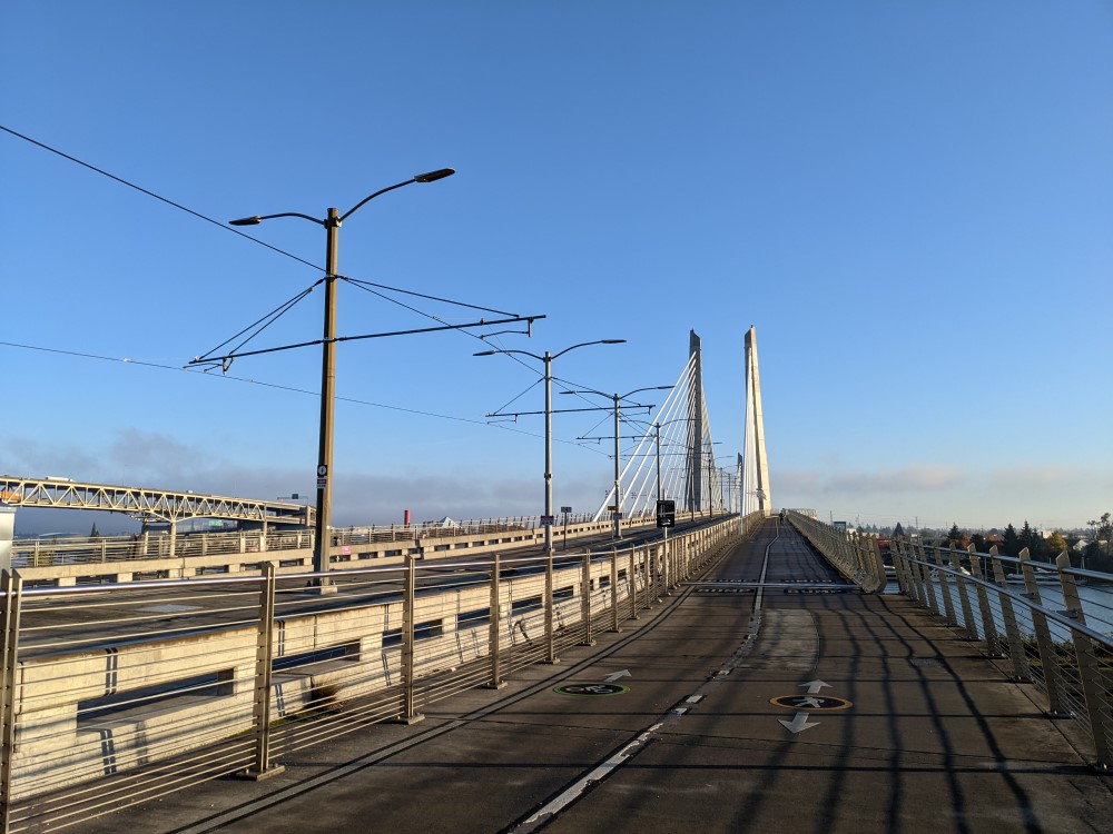
There are also a lot of interesting bridges, if you’re into bridges, including one car-free bridge.
It’s an actual city, unlike the others. The Japanese tea garden I remember being particularly worth a visit. Voodoo donuts was disappointing.
One thing I will note is that while they have transit, and I used transit, the transit system is really bad. Ok, it’s better than the transit in most of the other places I listed, but I expected much better, especially from a supposedly progressive city with a good bike system. Frequencies in particular are really low, if a bus comes every 15 minutes it gets a “high frequency” label. The light rail is cool but most of the time the area it served I could just walk in the same amount of time. It struck me as a dire warning of the possible future of San Francisco with a defunded transit sytem.
The one thing I’ll say in its favor is that you can use your credit card to tap on the bus.
Comments
With an account on the Fediverse or Mastodon, you can respond to this post. Since Mastodon is decentralized, you can use your existing account hosted by another Mastodon server or compatible platform if you don't have an account on this one. Known non-private replies are displayed below.
Learn how this is implemented here.